19
Oct
2015
Oct
2015
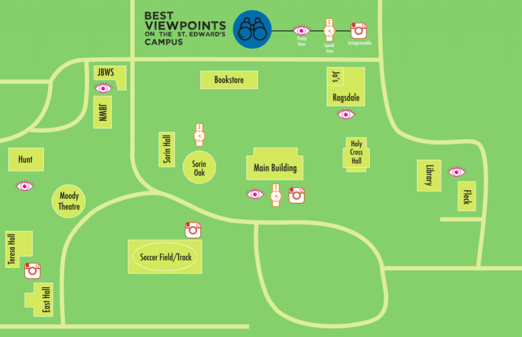
Maps Project: Artifact Map – Personal Geography
categories: GDES I
This personal geography map is map between home and school, which both happen to be on campus for me. For this map we were free to chose what exactly we were mapping between the two places along with what kind of agenda the map was portraying. I decided to map the best viewpoints on the St. Edward’s campus. Each viewpoint is categorized by one of three levels (Pretty view, Enjoyable to Spend Time There, and Instagram Worthy) with some fitting into more than one level. This map allowed me to learn more about the different components of a map and their individual importance – i.e. line weight, icons, networks, matrix, boundaries/divisions, scale, and political agenda.
