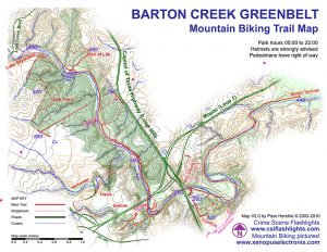
For this assignment, I chose to study the Barton Creek Greenbelt in Austin. One of the five methods for collecting research on a public space in Austin was to collect existing maps of the space, and then create a unique map of my own to represent a new idea, or update a previous one. When I visited the Greenbelt, I went with my family. I thought it would be a great way to spend the day in fantastic weather while getting homework done at the same time. It quickly struck me that although I, and other able-bodied individuals, enjoyed what the Greenbelt had to offer, my sister, who is wheelchair-bound, could not. I chose to make a map that highlighted which parts of the trail that I covered would be accessible and which parts wouldn’t be. I divided the Greenbelt’s terrain into three categories for feasibility of access: easy, difficult, and nearly impossible. Then I proceeded to assign these categories to the main trails that I walked over throughout my several visits to the trail, and added in other landmarks to the map for readability. 
-

- Official Map
-

- Minimalist Map
-

- Access Points
-
- Mountain Biking Trails