Seagrass Beds of the Texas Coast: an Extensive View
Link: http://tpwd.maps.arcgis.com/apps/webappviewer/index.html?id=af7ff35381144b97b38fe553f2e7b562
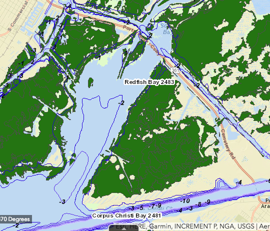
This data set belongs to the Texas Parks and Wildlife and is a map viewer that allows you to see all of the sea grass beds on the Texas coast. It is a pretty extensive map that takes you from one end of the coast to the other and shows you where the sea grasses are, and the area of certain sea grass beds. This data would be useful for a site analysis of the chosen area for my applied research project, Redfish Bay. Red fish Bay is about 8km of continuous sea grass beds. Having spatial data for Redfish Bay would allow us to select research sites and also specific areas of interest for our research.
I found this data set to be relatively interesting because it fits what I needed for my project pretty specifically but also there is a lot that can be added to it, such as types of sea grass that exist, which would really help scientists pin point areas that specific species may be inhabiting. There is alot of things that I may be able to add to this map and tailor it to my needs. I have attached an aerial view of the map focused in on Redfish Bay, so that you can see our research site.
