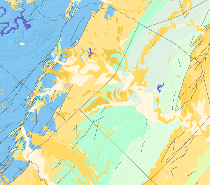
The USGS Texas Geologic map dataset, available at https://mrdata.usgs.gov/geology/state/state.php?state=TX, is an excellent resource for geologic mapping of the state of Texas. It includes csv and shapefiles for the geological attributes, geologic units, faults and lithology. The colors used are easy to observe and paints a useful portrait of the state’s surficial geology. I am able to analyze our tract of land for our research project at Onion Creek. The land between Onion Creek and Barton Springs where we will be collecting samples has an extensive network of karst features that enables groundwater flow which has been modified and altered by faults and extensional geological impacts. This information has already been mapped and compiled by the city of Austin which we are using along with well locations to select the best receptor points. However, we can use this GIS data to create our own maps in our final report. The dataset also includes hydrologic units and aquifers which will be useful when creating our final groundwater flow maps as well.
Map of Texas geologic units:

Map of Austin geologic units and fault features:
Any selected point on the map will have information about the point’s latitude and longitude, geographic context including county, state, country, continent or ocean; USGS quadrangles; underlying hydrologic units and regions, geologic formations and deposits with detailed lithology (clay, silt, gravel, etc.); airborne geophysical surveys with data type and description; continental crust type (lateral-extensional orogen), domain and region; mineral resource data including local quarries and commodities; assessment of unexploited mineral resources; energy resource assessment reports; national geologic map database references; and lastly, any USGS publications citing this dataset. This information is conveyed in a pop-up window on the website shown below:

Lithology polygon colors used for the map can be accessed here: https://mrdata.usgs.gov/catalog/lithclass-color.php