Wastewater Outfalls and Elevation Relevance to E. coli in Wild Basin Nature Preserve
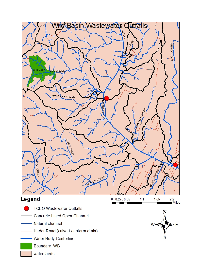
There are two data sets that I chose for their relevance to my research topic, which is studying the persistence of Escherichia coli (E. coli) within the streams of Wild Basin Nature Preserve (WBNP) in Austin, Texas. These data sets compare the location of Wastewater Outfalls in Texas (specifically focused on the Wild Basin region,) as well as the location of creeks, rivers and watersheds, shown below in Figure (1).
The second dataset I incorporated was an analysis of the elevation/contour lines, in comparison with the location of Wastewater Outfalls, creeks and rivers, as shown below in Figure (2).
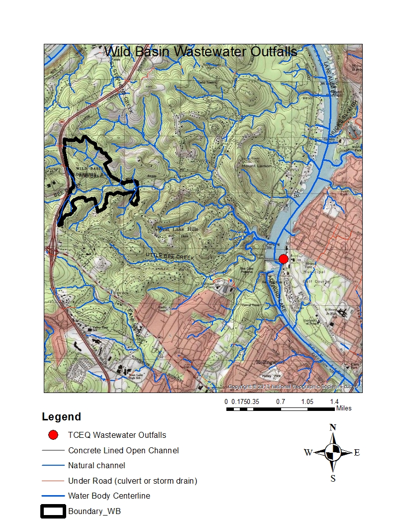
These two data sets are relevant for a variety of reasons. Firstly, E. coli is a ubiquitous microorganism and common subject of ecological and public health hazards. They are used as an indicator organism; in this case to indicate the efficiency of disinfection in wastewater treatment. In an ideal world, the effluent released from these outfalls would be free of E. coli, however if they aren’t properly disinfected and treated, they could serve as a possible source of contamination within Wild Basin and other streams. Furthermore, analyzing the elevation/contour lines can give us an understanding of the paths that water can take as well as understanding the possible routes of contamination, but also hopefully locating probable sources.
If interested in the location of Wastewater Outfalls, (as well as the location of other water characteristics,) you should visit the site below!