Written by: Christopher Quintanilla
For my internship experience, I elected to work with our on-campus arborist, Roy Johnson. When I first connected with Roy, it was clear he was excited to get help with the many ongoing and potential projects related to tree management and data collection. By the end of our conversation, we laid out a variety of options for improving campus sustainability operations and starting several long-term projects which could benefit both the Facilities and science departments. After reviewing the work completed by my predecessors in this position, Roy and I decided to focus primarily on completing the tree inventory for the campus and migrating the data to ArcGIS online where it will be maintained well after I leave the position. When not working on this inventory project, I work with Roy to submit tree removal applications to the City of Austin.
Day-to-Day Operations
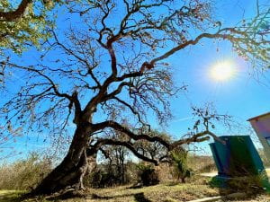
Most days on the job, I work independently on verifying the data for the campus tree inventory which includes: location, common name, scientific name, diameter at “breast height” (DBH), and general condition. I try to reserve this data collection for days with desirable weather for field work and tend to enjoy this aspect above all else because I can get lost in wandering through the different trees. I have not yet perfected my tree identification skills— mostly because deciduous tree are considerably harder to identify this close to winter — but I am actively refining this ability. Throughout the week, Roy reaches out to me to help me with tree species or just have questions about the difference in management between species. If there are diseased or dead trees identified during the week, Roy sends me the coordinates for the tree so that I may collect all the data needed for the permit. Below are some photos of a dead Live Oak behind the Fine Arts building; this is an especially interesting example of how tree management evolved over the years because there was concrete injected into the core of the tree to try to stop the spread of disease within the tree which of course was not done by our current staff.

On cold and wet days, which are more frequent than I prefer so far, I work on the visualization of the data in ArcGIS. I created a feature layer from the spreadsheets of data which I then placed in a map hosted on our St. Edward’s University server. In the beginning of my collection process, I had to wander the campus with a GPS receiver and a tablet to manually enter location data for each tree. However, with the appropriate ArcGIS credentials, I am now able to manipulate both the attributes of the trees and their location on ArcGIS using the ‘Collector’ app on my phone. Ultimately, I hope to finish the data collection and create a public-facing app which we can direct students and faculty to when they want to view or even edit the tree data for our campus.
Interesting Elements
One of the more interesting obstacles we ran into early in the semester was gaining access for both Roy and I to manage the ArcGIS Online data. While SEU does not currently seem to implement ArcGIS beyond the classroom, Roy and I envision more extensive use of the software’s capabilities in University Operations.
Surprises
I am surprised at the diversity of trees on campus and how complex the management of trees is with arising challenges such as winter storms and increasingly common tree diseases. For the rest of my time in this position, I am aiming to perfect my tree identification skills and improve my general knowledge of small-to-medium scale land management operations.